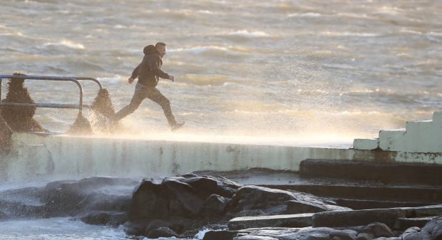
Tayside and Fife look likely to miss out on the worst of the weather as Storm Brian brings a “weather bomb” to the UK and Ireland this weekend.
There was some confusion on Thursday morning after the Met Office’s Irish counterparts, Met Éireann, gave the “deep area of low pressure” a moniker before it met the criteria for an official storm.
Yellow wind warnings have been issued for Wales, the West and East Midlands, London, and east, north-west and south-west England on Saturday.
Gusts of as high as 70mph are being predicted, however eastern Scotland is likely to miss the worst of it.
A yellow warning of rain is also in place for Northern Ireland today.
The weather front will undertake “explosive cyclogenesis” – known as a “weather bomb” – before reaching the UK and Ireland as Storm Brian.
Met Éireann has now officially named Storm Brian the second storm of the season.
#StormBrian has been named by @MetEireann as the second storm of the season, bringing strong winds to Ireland and the UK on Saturday pic.twitter.com/r2zxzqeSrL
— Met Office (@metoffice) October 19, 2017
Met Office meteorologist Emma Sharple said people should keep an eye for updates from the organisation in the coming days.
Tayside and Fife looks likely to miss the worst of the conditions on Saturday, save for some heavy rain.
Earlier Ms Sharples said the weather front moving in from the Atlantic, though it will bring some very strong wind, did not meet the “given criteria” required by the Met Office for a storm.
She added: “There will be strong winds on the western side of Scotland. I don’t think on the eastern side there is anything to be concerned about. But things can change, it is a developing situation.
“It is quite a deep system. At the moment as it moves across the UK we’ll still have some very strong winds along the southern side.
“We’re going through the process of assessing. It is a deep area of low pressure coming to the mainland. It will bring some depression.
“Late Friday into the west really rain will steadily increase. In the early hours of Saturday morning warnings are coming into force.”
She added: “For you (in Tayside and Fife) there will be spells of rain throughout Saturday, steadily breezy throughout Saturday itself.
“There will be further bits of rain coming through. There will be some heavy bursts, we are not expecting to warn for that. You won’t see particularly strong wind.”
Chief Forecaster Dan Suri said: “Storm Brian is expected to bring strong winds to southern and western areas early on Saturday morning.
“The first and most significant land-based impacts will be in the southwest of Ireland, hence the Amber warning from Met Éireann. At the moment, we don’t expect the same level of impacts for the UK.
“As we go through Saturday morning and early afternoon the strong southwesterly winds affecting the south-west will transfer east and slowly change direction as they will become westerly towards the end of the warning period.
“Gusts exceeding 50 mph are expected widely within the warning area, with gusts of around 70 mph along exposed coastal areas.
“These are expected to coincide with high tides, leading to locally dangerous conditions in coastal parts.”
Earlier this week Storm Ophelia battered Ireland, leading to the deaths of three people, leaving 360,000 without power, uprooting trees, blocking roads and even tearing off the roof of a primary school in the Douglas area of Cork.


