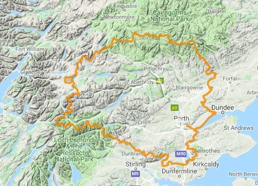
An enduring downpour of rain has prompted weather and flood alerts across Tayside – with 80mph winds also possible at the end of the week.
The Met Office has issued a yellow warning for “heavy rain” which is effective in Tayside and Fife from 12.15am on Monday until Tuesday at 11.45pm.
The forecast for “persistent and heavy rain” has also prompted a flood alert from the Scottish Environment Protection Agency (Sepa) for the Tayside region.
Western parts of Perthshire and Fife will be worst hit by the weather – where low-lying land is expected to be affected by surging rivers.
And a separate Met Office weather warning for wind in Tayside and Fife will be in place from 5am until 9pm on Friday – with gusts of up to 60mph possible.
The forecaster said there is a “small chance of injuries and danger to life” as a result flying debris or large waves in coastal regions, as well as damage to buildings and power cuts.
A yellow severe weather warning for #wind on Friday has been issued: https://t.co/QwDLMfRBfs. Stay #weatheraware @metofficeuk pic.twitter.com/hSR13cOSDf
— Met Office (@metoffice) October 8, 2018
There could also be delays to road, rail, air and ferry travel; as well as route and bridge closures.
The Met Office warning for Friday states: “Gusts (of) 50-60mph are likely in some places, with potential for gusts of 70-80mph around exposed coasts and hills, with large waves an additional hazard.
“There is a small chance of gusts over 80 mph in the Western Isles during the afternoon and evening.
“The strongest winds are expected across Northern Ireland during the morning and Scotland through the afternoon and evening.”
Driving conditions are also predicted to worsen as a result of the downpour on Monday and Tuesday.
A Met Office statement said: “Heavy rain will affect much of western Scotland, especially later Monday and throughout Tuesday.
After a wet day yesterday, further heavy rain for western Scotland could bring event totals of around 260 mm to some exposed parts by the end of Tuesday #weatheraware https://t.co/B654Twp74P … pic.twitter.com/ZGGgaYMlNV
— Met Office (@metoffice) October 8, 2018
“Spray and flooding on roads will make journey times longer. Bus and train services affected with journey times taking longer.
“Persistent, and at times heavy rain will remain over parts of western Scotland throughout Monday and Tuesday.
“The west Highlands may see some breaks in the rainfall on Monday morning in particular before the rain spreads back into this area.
“Through Monday and into Tuesday widely 40-60mm (1.6in-2.4in) of rain is expected with totals of 100-150mm (3.9in-6in) over some upland sites exposed to the strong south-westerly winds.”
The Sepa flood alert reads: “A flood alert has been issued for Tayside. A spell of persistent and heavy rain is expected to continue to affect the area through the remainder of Sunday and into Monday.
“Some localised river flooding to low-lying land and roads is likely, this will be accompanied by difficult driving conditions and ponding of water in known trouble spots.
“The greatest risk is in western parts of the area. Further updates are likely in the next few days.”


