I’m trudging along the edge of a stubble field in a mission to find Pitcur earth house.
It’s a curious, little-known underground structure – also known as a “souterrain” – that was discovered in 1878 by a farmer.
The site is around three miles south-east of Coupar Angus, close to Leys farm, and marked on maps.
But, unlike the better-known earth houses at Tealing, Carlungie and Ardestie in Angus, which are maintained by Historic Environment Scotland and easy to locate and access, finding and entering Pitcur is a bit of an adventure.
For anyone not in the know (admittedly, I wasn’t sure either), I should address the question: “What, indeed, is an earth house?”
Hideout or storage place?
Numerous theories have been suggested, including that they were secret underground hiding places in which folk could seek refuge during raids.
It’s also been proposed that these stone-lined underground passageways, typically dating to the Iron Age, were simply used as cool storage areas for grain and produce.
Most are thought to have been destroyed, or at least filled in, around the late AD 100s – coinciding with the Roman withdrawal from Britain.
It doesn’t take long to park (safely) in a layby on the A923 and stroll along a field fence to reach Pitcur earth house.
I’m lucky that the sat nav app on my phone more or less brings me right to it.
It’s a bit of a crash and stumble through undergrowth but I’m in no doubt I’ve found it when I spot an overgrown fenced-off area.
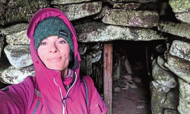
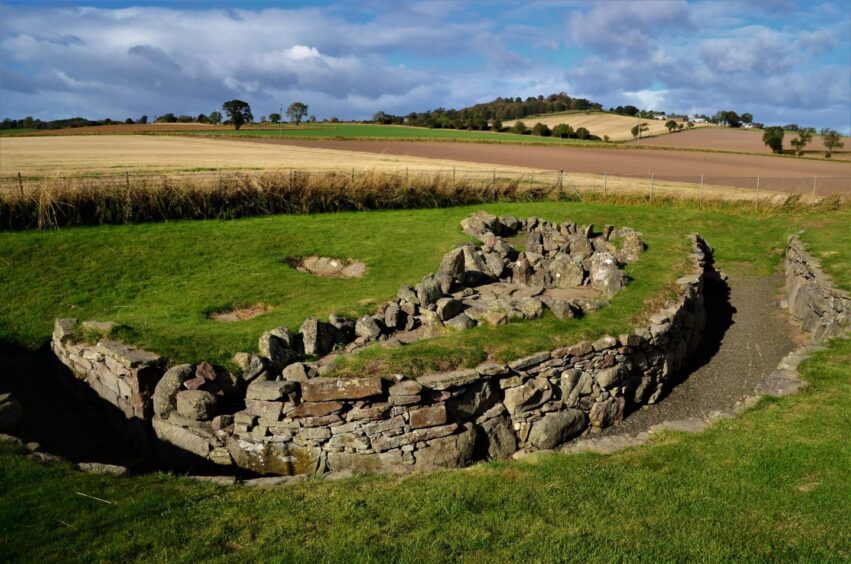
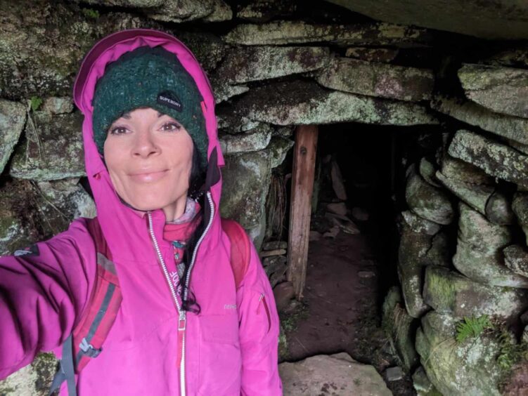
Scaling a makeshift wooden gate into a grassy enclosure, I climb down a slope into an open-roofed passage.
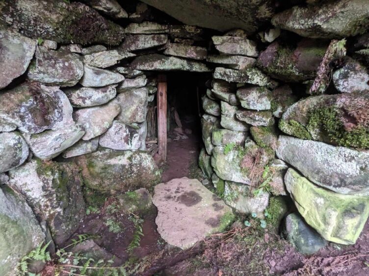
When I turn the corner, I spy the entrance to a stone-roofed chamber. There’s a sturdy wooden post at the doorway, possibly helping to keep the structure from collapsing, and a huge stone lying on the ground. Perhaps this was the old stone “door” used to block the entrance?
Dark, dank and dingy inside
As I prepare to head in for a nosey, I feel a surge of excitement; it’s as though I’m about to enter Narnia itself.
It’s just as well I’ve brought a torch because it’s dark, dank and dingy inside.
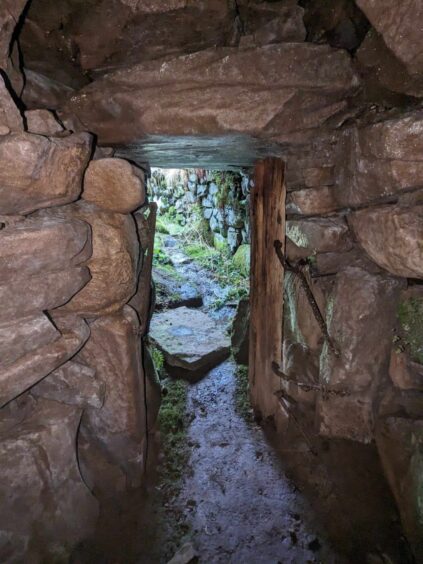
It’s an incredibly long passageway covered with huge stone slabs – perhaps this should be a warning to any would-be explorers with claustrophobia – but it’s high enough to stand upright inside.
Once I’ve made it to the end of the “tunnel”, which appears to be blocked by earth, I stand for a while, trying to imagine what went on here through the ages.
What was the earth house’s purpose?
We’ll likely never know what this earth house was used for, but theories – including that it was a food storage site, a cattle shelter, or a hideout for local tribes or clans during raids – abound.
Another theory suggests that the construction was used by shamans or religious groups to conduct rituals.
Fascinatingly, it’s also been suggested that there might be a yet-to-be-discovered timber roundhouse associated with Pitcur.
Certainly, it’s an enigmatic structure – and one that just keeps on giving.
As I head back towards the entrance and my eyes adjust, I spot what looks like a stone hearth, or fireplace.
I can just imagine folk warming their hands here, or perhaps cooking a wild boar…
Cup-marked stones
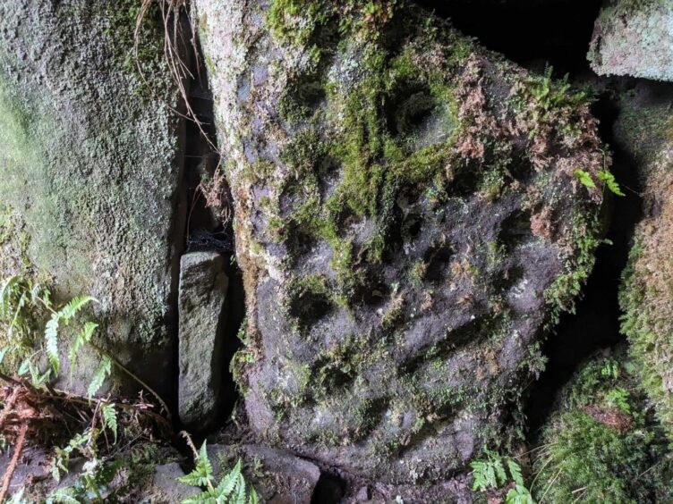
Heading out into the light, I linger at the doorway and notice a faint cup-marked stone covered in moss.
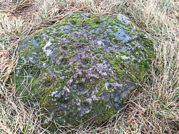
I’d read that there was another cup and ring-marked stone at ground level, and after a bit of scrubbing around in the undergrowth, I find it and whoop with joy.
It must have been an exciting day for tenant farmer John Granger back in 1878.
When his plough hit a huge stone, he likely scratched his head and then got out to investigate.
When he moved the stone, it revealed the mysterious underground warren of tunnels.
While Granger excavated the earth house himself, his son said the only objects found by members of his family were a small red clay bowl of Samian ware in pieces, and a Roman coin.
Further investigations threw up a bronze pin and a selection of stones and beads, but sadly, all these relics have been lost.
There are supposedly at least seven impressive “petroglyphs” or rock carvings, within Pitcur souterrain – four complex cup-and-ring designs and three basic cup-marked stones – but I only spotted two.
As well as the stone-roofed subterranean “cave”, there are another two curving passageways, although these are more or less ruined and roofless.
Inhabited by merry elfins?
The site was allegedly known locally as The Cave in earlier centuries, with an associated folk legend about a community of “merry elfins” who lived inside it.
I don’t spot any such creatures, but I’m more than mesmerised by this truly magical place.
It’s a short walk uphill to reach another fascinating local historic feature – ruined Pitcur Castle.
I’ll reveal all about my slightly precarious exploration of this roofless late 15th Century tower house in another column!
- Pitcur souterrain lies in a field just off the busy A923, about three miles southwest of Coupar Angus. Be sure not to march through any crops!
- The word ‘souterrain’ comes from the French, ‘sous terrain’, which means ‘underground’.






Conversation