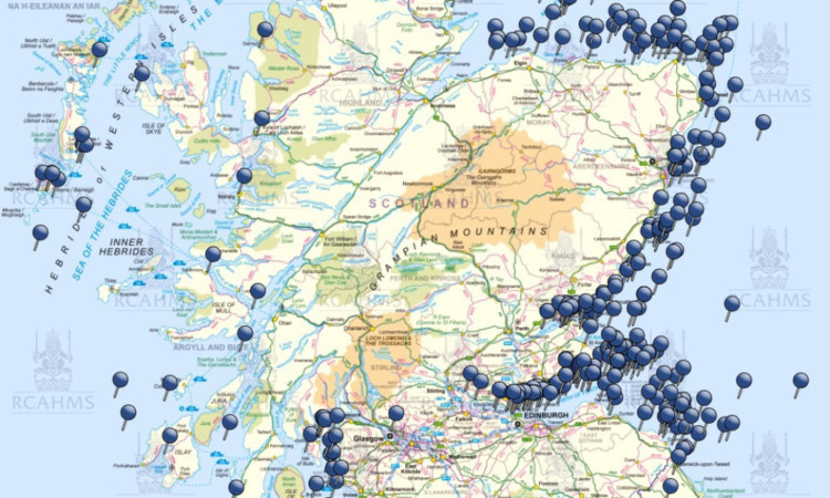
A “wreck map” showing 1,200 years of shipwrecks in Scotland has been published by researchers.
The Royal Commission on the Ancient and Historical Monuments of Scotland (RCAHMS) and Historic Scotland have produced the interactive map to promote Scotland’s historic maritime environment.
The map was made possible by the recent donation of a private collection of photographs and materials from the pioneer of nautical archaeology in Scotland, Colin Martin.
And it has been twinned with thousands of records held in the commission’s online database, Canmore, along with records from commercial consultants WA Coastal and Marine and ORCA.
The resulting data chronicles more famous shipwrecks such as the HMS York classed as Arbroath’s biggest maritime disaster along with lesser-known ones such as the Mary near Montrose in 1842, the Sarah in the Tay near Dundee in 1865 and the Kate Thompson off Crail in 1895.
RCAHMS archaeology projects manager and maritime archaeology specialist George Geddes said: “As Scotland’s marine environment is undergoing its latest change, with the growth in offshore renewable energy and proposals for marine protected areas, we have collated a number of datasets in one place for the first time, to present marine heritage information in a more intuitive way.”
Visit www.rcahms.gov.uk to see the map.
