Nearly 2,200 people have signed a petition calling on Perth and Kinross Council to repair a popular riverside walk.
There was a major landslip in December on Oakbank Road in Blairgowrie, which runs north from the town on the west bank of the river Ericht, leaving the road in a dangerous state.
Intended for pedestrian access only, the road belongs to Sir William Macpherson of Cluny, but responsibility for its upkeep now lies with the council.
In 1989, Sir William leased the road to the council for 99 years at £1 per annum, provided that the council maintained the path for the use of pedestrians and took responsibility for any tree damage, road maintenance and other mishaps.
“The road has been in existence for well over 170 years and was the main access road to the jute mills, which were built along the river’s edge in the early part of the 19th Century,” said Dr Jessie Shaw, chairwoman of One Voice Volunteer Group in Blairgowrie.
“It has withstood many storms and floods over that period of time.
“It is still of great importance to the town. This is a key attraction for visitors and keen walkers to this picturesque riverside walk.
“It is the starting point of the ever-increasingly popular Cateran Trail. Blairgowrie and Rattray was once a thriving mill town and centre for berry picking but must now rely on its tourist attractions for sustainability. The riverside affords access for anglers to the river.
“It is an alternative walking route to and from Rattray, via the wooden footbridge at the Oakbank Mill.
“Cargill’s leap and the other viewing platforms (to see salmon leaping) are placed along this road. The Perth and Kinross Countryside Trust spent many months and money improving this road only two years ago. Further work to add sculptures and information boards was planned.
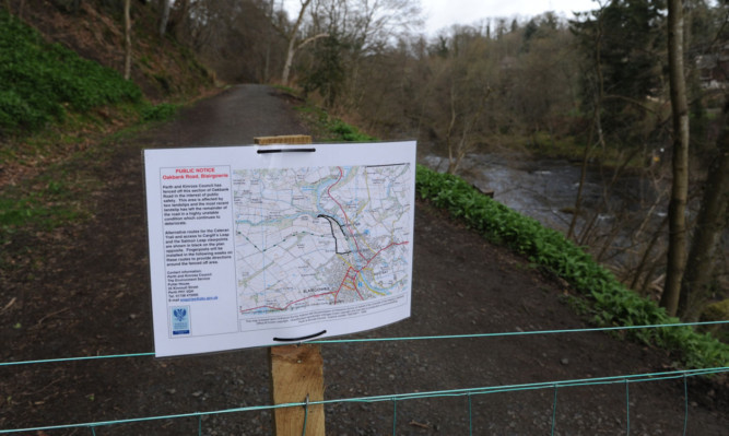
“In December 2012, the land slipped down towards the river, eroding the footpath and making it dangerous for the public to walk, so Perth and Kinross Council erected barriers to close the footpath to the public.
“Many months have passed, with no obvious plan to restore this important walkway.”
Some local people are of the opinion that work done in recent years to the drainage system in the ditches on either side of the road has been responsible for the loosening of the soil and the subsequent landslip.
The One Voice Volunteer Group helped to organise the petition, which has now collected 2,185 signatures equivalent to 25% of the population of Blairgowrie.
The council responded: “Following the major landslip on the river Ericht at Oakbank Road earlier in 2013, Perth and Kinross Council has recently received the results of a preliminary site inspection carried out by its consultant engineers. The initial inspection has confirmed that the affected sections are presently unsafe and recommended that they should not be reopened unless a suitable repair can be made.
“However, due to the severity of the landslip, and in order to properly understand why it occurred and if there are any possible solutions, a further investigation is needed. This will be undertaken by sinking four boreholes at different points along the road to investigate the full extent of the problem.
“The council has written to the landowner for permission to do this and received their consent.
“Once the borehole investigation has been undertaken and the engineers have had time to study the results, we will provide further information to the local community.
“In the meantime, we appreciate the inconvenience this has caused and would thank residents and visitors alike for their understanding that public safety is our highest priority.”