Calendar An icon of a desk calendar. Cancel An icon of a circle with a diagonal line across. Caret An icon of a block arrow pointing to the right. Email An icon of a paper envelope. Facebook An icon of the Facebook "f" mark. Google An icon of the Google "G" mark. Linked In An icon of the Linked In "in" mark. Logout An icon representing logout. Profile An icon that resembles human head and shoulders. Telephone An icon of a traditional telephone receiver. Tick An icon of a tick mark. Is Public An icon of a human eye and eyelashes. Is Not Public An icon of a human eye and eyelashes with a diagonal line through it. Pause Icon A two-lined pause icon for stopping interactions. Quote Mark A opening quote mark. Quote Mark A closing quote mark. Arrow An icon of an arrow. Folder An icon of a paper folder. Breaking An icon of an exclamation mark on a circular background. Camera An icon of a digital camera. Caret An icon of a caret arrow. Clock An icon of a clock face. Close An icon of the an X shape. Close Icon An icon used to represent where to interact to collapse or dismiss a component Comment An icon of a speech bubble. Comments An icon of a speech bubble, denoting user comments. Comments An icon of a speech bubble, denoting user comments. Ellipsis An icon of 3 horizontal dots. Envelope An icon of a paper envelope. Facebook An icon of a facebook f logo. Camera An icon of a digital camera. Home An icon of a house. Instagram An icon of the Instagram logo. LinkedIn An icon of the LinkedIn logo. Magnifying Glass An icon of a magnifying glass. Search Icon A magnifying glass icon that is used to represent the function of searching. Menu An icon of 3 horizontal lines. Hamburger Menu Icon An icon used to represent a collapsed menu. Next An icon of an arrow pointing to the right. Notice An explanation mark centred inside a circle. Previous An icon of an arrow pointing to the left. Rating An icon of a star. Tag An icon of a tag. Twitter An icon of the Twitter logo. Video Camera An icon of a video camera shape. Speech Bubble Icon A icon displaying a speech bubble WhatsApp An icon of the WhatsApp logo. Information An icon of an information logo. Plus A mathematical 'plus' symbol. Duration An icon indicating Time. Success Tick An icon of a green tick. Success Tick Timeout An icon of a greyed out success tick. Loading Spinner An icon of a loading spinner. Facebook Messenger An icon of the facebook messenger app logo. Facebook An icon of a facebook f logo. Facebook Messenger An icon of the Twitter app logo. LinkedIn An icon of the LinkedIn logo. WhatsApp Messenger An icon of the Whatsapp messenger app logo. Email An icon of an mail envelope. Copy link A decentered black square over a white square.

Drones to be used to help find North Sea oil reserves

Unmanned drones are to be used to scan remote rock formations in the North Sea.

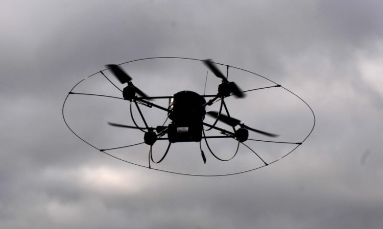
Unmanned flying drones are to be used to map geology from the sky in an attempt to recover more oil from North Sea reserves.

Scientists at the University of Aberdeen will use the remotely-operated machines to scan remote rock formations for information about what lies beneath.

The research work, a collaboration with academics at the University of Bergen in Norway, is supported by 24 oil companies.

Professor John Howell, a geoscientist at the University of Aberdeen, said: “When you drill a well in the North Sea, you can directly measure the rocks in the borehole, however you have much less certainty about what is going on away from the well.

“Given that two wells are often several miles apart, predicting what the rock layers in between the boreholes look like is a huge challenge.

“To solve this problem we look at similar rock units which occur in cliffs above sea level and we use the drone to make extremely detailed 3D models, which we can then adapt for the subsurface.

“This gives us a much better idea of what conditions are like between these two bore holes and then allows us to predict how the oil will follow and how much we can recover.

“The advantage of the drone is that it allows us to collect large volumes of data from otherwise inaccessible cliff sections in remote and often dangerous places.”

The group have already been using drones to map cliff sections. Their computer stabilisation and multiple motors means they can provide an accurate map of the rock formations.

The work is part of a project called SAFARI which started in the late 1980s.

Mr Howell said: “The original workers on the project have seen data collection technology come on in leaps and bounds since then, but the introduction of laser scanning was one of the biggest improvements.

“We’re now able to create virtual rock formations that are accurate to within less than a few millimetres.

“The overall project’s goal is to develop a fully searchable database of these relevant rock formations which will help oil companies build better models of the subsurface and improve recovery from oilfields.”